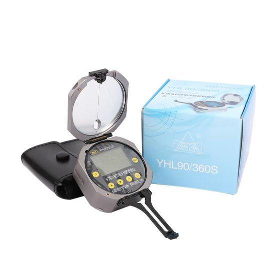
Digital laser geological compass is a new kind of geological compass which is developed in China and has completely independent intellectual property rights.
Introduction to the
It is based on a number of patented technologies (applications (patents) : Ma Qingxun), use a variety of sensors, photoelectric integration is used to design the structure, not only completely with the traditional mechanical pointer geological compass measurement location, the basic function of tilt, has integrated laser alignment, laser measuring tilts, GPS positioning, time, temperature, pressure, elevation, stopwatch, multiple functions such as data storage, magnetic anomalies alarm at an organic whole, and has a professional attitude measurement software functions automatically. Compared with the traditional geological compass, it has the characteristics of non-contact measurement, accurate measurement, efficient and convenient, safe and reliable, light weight, digital storage, long standby, magnetic field alarm and so on. It is a brand new comprehensive geological tool. The similar product "mine intrinsic safety type geological compassing instrument" (YHL90/360s type) has passed the safety standard certification of "safety mark center of national mining products safety mark", and the relevant national performance inspection certificate, can be widely used in field exploration, all kinds of mines and household sports and other fields
Functional features
Compared with the traditional mechanical pointer type compass instrument, the instrument has the following features:
L Auxiliary laser: using laser pointing and laser casting function, can accurately calibrate and point to the azimuth or inclination of the measuring object, greatly reduce the measurement error caused by the measurement of local objects, or the inaccurate targeting of the object.
L Accurate reading: digital display of measurement results, eliminate reading error.
L Tilting compensation: measurement of azimuth, no need to put the compass level, even if tilt 40° can be accurate measurement of azimuth.
L Intelligent attitude measurement: Through the special algorithm design of geological body attitude measurement program, the geological body attitude measurement can be quickly completed within 1 minute, and the measurement results can be saved, greatly improving the measurement accuracy and measurement efficiency.
L Laser Baselines: Two baselines, up to 150m in length, are available for downhole geological sketching and automatically record baseline parameters.
L Magnetic interference alarm: When the environmental magnetic field strength exceeds the limit, the instrument alarm prompts the user to stay away from the strong magnetic field.
L Data storage: long-term storage of the latest 102 sets of measurement results, and the accurate timestamp information is stored for easy search.

LGPS positioning: provide built-in GPS positioning function, can measure the GPS positioning coordinate data of the observation site, the error is 5-15m.
L Temperature, pressure and elevation measurement: it can quickly obtain ambient temperature, atmospheric pressure and elevation values, and provide rich data results for field exploration.
L Long standby time: lithium battery power, standby time can be up to 25 days after full charge, normal working time is 7-15 days (1-2 hours per day)
Basic operation
1. Setting of magnetic declination
Open the set magnetic decrement Angle in the menu, enter the magnetic decrement Angle of the measured area (positive is subtraction operation, that is, the current magnetic azimuth minus the set value, negative value is the opposite);
2. Azimuth measurement
Lighting the longitudinal laser so that the direction of the laser beam points to the direction to be measured; Under the condition that the inclination of the instrument is not more than 40°, the azimuth data on the LCD screen can be read directly, that is, the current azimuth measurement results.
3. Tilt Angle measurement
3.1 Contact measurement
The instrument is designed with electronic horizontal scale, which is designed with two vertical calibration bars and digital display. The tilt Angle can be measured with the instrument pitching forward and backward and rolling laterally.
3.2 Non-contact measurement
The transverse laser line is the same as the roll Angle. Turn on the transverse laser and aim the laser line at the object that needs to measure the inclination. The inclination can be measured quickly and accurately.
